
Mill Hill conservation area
Skip to:
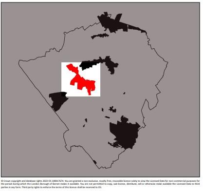
Location
The Mill Hill conservation area covers approximately 152 hectares of land at Mill Hill towards the northwest corner of the Borough.
It includes a scattering of institutional buildings and houses strung out for a mile along the high ground of The Ridgeway.
The Mill Hill conservation area looks in both directions over green belt countryside, from Burtonhole Lane to the southeast and Marsh Lane to the north.
There are approximately 260 houses comprising brick and weatherboard cottages typical of rural Middlesex interspersed with a large number of rambling institutional buildings.
Successors to the earlier private mansions of wealthy Londoners were attracted to Mill Hill by the fine views. A surprising number of these older buildings remain embedded in these later complexes e.g. Littleberries, which now forms part of St Vincent’s, and Belmont House that forms part of Belmont School.
The 2001 census showed that approximately 4,170 people live within the area and that the majority of homes were in private ownership.
Description
The strong unified manors and institutions from the medieval period onwards have influenced the uses of today.
The heavy clay soil was not attractive to early settlers as it was difficult to drain, lacked a navigable river and was unsuitable for arable farming and crops. Therefore, development resulted along the gravel capped ridge ways with interconnecting roads leading off it.
Today the area is characterised by institutional buildings, particularly religious institutions and schools, interspersed with clusters of modest houses, along a long linear route of the high ground known as The Ridgeway.
The large schools in the conservation area include Mill Hill School, Belmont School and The Mount. These schools are private and cater for the full range of ages. They draw pupils from wide catchments primarily over the North London region. The majority of children travel to school by car and the daily traffic patterns reflect this.
Mill Hill School was founded as a Protestant Dissenters Academy in 1807 on the estate of noted botanist Peter Collinson. Many of the shrubs and trees still to be found on the Mill Hill estate date from Collinson’s time.
Other notable institutional uses include the religious orders such as The Priory, St. Vincent de Paul Convent, St. Josephs and a Roman Catholic Missionary on Lawrence Street (which is now vacant and awaiting an alternative use). These buildings are fundamental to defining the character of the area. They have a consistency in their grand scale, imposing appearance and spacious settings.
Residential dwellings are mainly characterised by modest brick and weatherboarded cottages. Three picturesque clusters of smaller houses and cottages can be found along The Ridgeway at the western end, the junction with Hammers Lane and High Street. Along with the cluster of houses at the top of Highwood Hill, these areas reflect a country village quality.
The Three Hammers Public House is a focal point within the conservation area, together with The Rising Sun on Highwood Hill and The Adam and Eve Public House at the eastern end of The Ridgeway. They all serve wide areas beyond the boundaries of the Conservation Area.
Hammers Lane accommodates the Linen and Woollen Drapers Cottages Homes (now known as The Retail Trust). The Retail Trust serves a specific sector of the local elderly population, assisting retired people from the Drapery trade with a minimum of 15 years service. It is a semi institutional development, which sits either side of the road and is comprised of compact one and two storey cottages in the Arts and Crafts tradition. A central 2 storey building (Marshall Hall) sits within the development on the eastern side of the road and is complemented by a number of new buildings providing both residential and community type uses for the residents.
Winterstoke Gardens at the southern end of Hammers Lane is a small development of sizeable 2 storey properties in the Arts and Crafts tradition, reminiscent of Garden City planning.
Wills Grove is situated nearby and comprises a number of large grand buildings, formerly used as boarding and staff houses associated with Mill Hill School. These buildings have mainly remained in their original use, although some have been sold off and are now used as private houses and apartments.
Other institutional uses in Mill Hill include the imposing National Medical Research Institute and Watch Tower House at the eastern end of The Ridgeway. These buildings occupy large sites with car reliant users. The National Institute for Medical Research building was built just before the Second World War. Its green roof is easily recognisable and the building is a prominent landmark.
The Ridgeway and Highwood Hill are busy vehicular routes that are key links across Mill Hill in the northern part of this area. The surrounding land is mainly agricultural.
The combination of a countryside setting, attractive long distant views, relatively level terrain and network of bridleways attracts walkers and horse riders.
The area is considered very desirable for residents, being within easy reach of central London with a nearby underground station at Mill Hill East, whilst in a semi rural setting. The conservation area is generally quiet and is typical of a number of small villages in a countryside setting.
Mill Hill is generally dark at night in line with its rural character with modest activity related to the village hall and the public houses.