
Totteridge conservation area
Skip to:
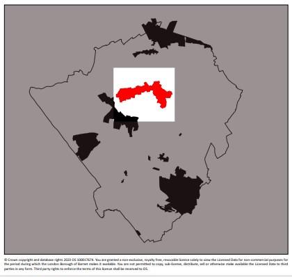
Location
Totteridge Conservation Area is located in the northern part of the Borough along a gravel ridge of higher ground that runs from west to east.
The road running along the ridge forms an important route linking Mill Hill and the north with Whetstone and Barnet. The conservation area comprises a ribbon of development clustered along the highway.
It is set within green fields on three sides, sloping down to Dollis Brook to the north and Folly Brook to the south, giving these parts of the borough a distinctive character.
The open land forms part of London’s Green Belt and part of a larger area of open land of high landscape quality, stretching westwards over parts of Harrow Weald.
The eastern boundary is formed by the suburban development of Totteridge and Whetstone.
There are approximately 450 properties within the conservation area and the 2001 census records a population of around 1,700
Description
The origin of Totteridge is as an agricultural settlement and its importance for the local economy continued into the early 20th century. Totteridge still has some of London’s richest surviving hay pastures and 3 18th century barns. The early farmhouses scattered across the ridge were modest, timber framed buildings, rural in character. Several still survive contributing to the character of the area.
The medieval feudal system with its ecclesiastical overlord led to the building of a 13th century chapel in Totteridge. It was dedicated to the patron saint of Ely. The chapel encouraged the bishops of Ely to use Totteridge as a stopping point from London to Ely. St. Andrew’s Church is built on the site of the earlier chapel and is still important as a focal point for the village and the local community.
St. Andrew’s Church is of 13th century origins and was originally named St. Etheldreda (Latin) or St. Audrey’s (in the vernacular) after the founder of Ely Cathedral. It became St Andrew’s in 1570 following the dissolution of the monasteries to remove this link with the Roman Catholic church. The current building is a Regency style church built in 1790 on the same site as the original church. The wooden tower, constructed of Hertfordshire weatherboarding, possibly dates from the Elizabethan era.
Residual manorial land survives and stretches across Totteridge as wayside verges. The successive Lord’s of the Manor lived in large houses built quite close to the Church. The earlier manor houses have not survived although their influence on the size and type of houses can be seen in later development, with houses often built on the site of earlier ones.
From the 16th century onwards, farmsteads were interspersed with large houses. These were built for wealthy landowners attracted to Totteridge. There were four large mansion houses along the main road, Copped Hall, Poynters Grove, Barns Park and Totteridge Park. They encompassed large areas of formal gardens, farms, labourers’ cottages and servants’ quarters.
A combination of their grand appearance, high architectural quality and these important residents such as the Lord of the Manor, the nonconformist Puget family and Cardinal Manning and their local patronage, increased the perception of Totteridge as a desirable area for wealthy people.
Through the patronage of their occupiers, land was given for the village school, the churchyard, the building of the bridge across Dollis Brook and the burial ground at Whetstone chapel site. Of the four mansion houses only Totteridge Park still survives.
The 18th and 19th centuries saw an increase in wealthy residents, attracted by fine views and spacious grounds. This encouraged the building of some noteworthy houses around St. Andrews Church, the Green and along Totteridge Common. Often designed by eminent architects whose work influenced the design of later houses throughout Totteridge. They include:
- Norman Shaw’s Old English style in Trevanion and Ellern Mede
- Charles Nicholson’s red brick, Classical style shown by The Grange and The Vicarage
- T.E. Collcutt’s simplified Old English style displayed by The Croft, Fairspeir and The Lynch House
Several small lodges and workers cottages of vernacular, domestic architecture were built during the 18th and 19th centuries. These extended the village and added a rich variety and complexity to the area.
Totteridge is still almost exclusively residential, although there are a number of residential religious institutional uses such as St Edwards College, one working farm, a church and presbytery, a local school, pub and restaurant and a vast expanse of open land.
The surrounding land is exclusively agricultural although much is also used for recreation. The countryside setting, attractive long distant views, relatively flat terrain and network of bridle ways attract walkers and horse riders.
The area is generally quiet and offers a secluded countryside quality, particularly Totteridge Green and locations which are set well back from the road. Even the more suburban areas such as Grange Road and Northcliffe Drive Avenue have a quiet and secluded residential character.
The village school, village hall and Orange Tree Public House are all located close to the Green within proximity to one another. This area tends to be slightly busier and at night there is activity related to the village hall and the public house.
The main roads such as Totteridge Lane, Totteridge Village and Totteridge Common are busy with fast moving traffic, particularly during rush hours. The route is used by commuters to travel between the east and west sides of the borough.
The area is generally considered very desirable and in the recent past was certainly known for housing the rich and famous looking for exclusive property within reach of central London in a countryside setting. The area generally is relatively dark at night in line with its rural character.